Home
Carpool
Contact Info
Debrief
Fleet Info
Links
Logistics
Marks & Courses
Photos & Videos
Procedures
Results
Rules
Sitemap
Home
Carpool
Contact Info
Debrief
Fleet Info
Links
Logistics
Marks & Courses
Photos & Videos
Procedures
Results
Rules
Sitemap
|
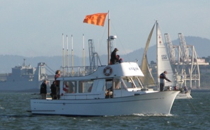
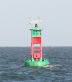
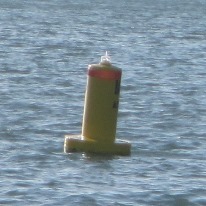
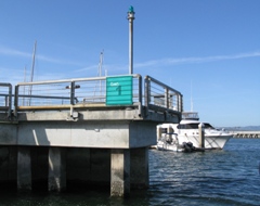
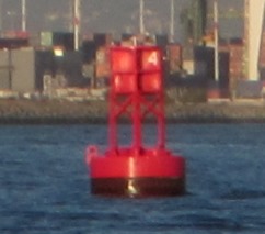
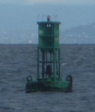
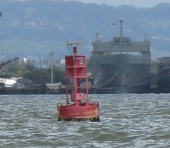
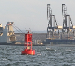
Marks & CoursesMarks (Waypoints)Races in the Friday Night Series are sailed around marks in the south bay waters of San Francisco Bay. For 2016, there are 11 marks and a total of 20 numbered courses around the marks. Each class generally races on a different course. See the start-of-race sequence to find out how the Race Committee announces which course each class should use. The map below shows the SBYC race area and the approximate mark locations. The marks are shown in the photos below the map. Start Line
Weather Marks
Leeward and Reaching Marks
The table below lists the mark locations. Additional formats for mark data:
Note that you can also edit the Google spreadsheet above and export the data in various formats, like pdf and Microsoft Excel. For chart information from the NOAA, see Chart 18650 and the corresponding chart image. Courses (Routes)The table below lists the SBYC courses for 2016. Course notes:
Additional formats for course data:
GPS notes:
|